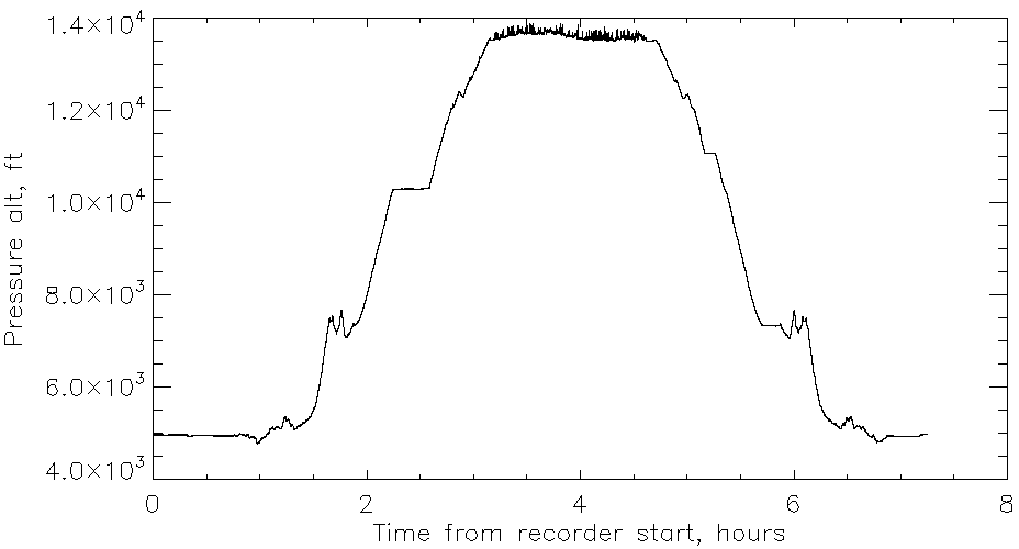
This is the benchmark on the "top" of Mt Evans. I say "top" because there is another boulder within 20 feet which is about 3-4 feet higher, and another one within 50 feet which is 2-3 feet higher still. However, this is the one with a readable altitude (if just barely). The two devices are my phone in GPS mode, and the controller for Project Yukari, running a program called "Southwest" because I intend to take it on various flights I make around the country in the future. One of the interesting things about this recorder is that it carries a pressure and temperature sensor.
The pressure sensor says we didn't quite get to 14000 feet, in contradiction of the GPS sensors
I was hoping for a pressure of less than 0.6atm, and I got it. You really can feel the difference between 84% in Longmont and 59% up there.
I was not dressed for 40°F weather. There was some snow still on the ground. I think it was new (couple of days) snow.


No comments:
Post a Comment